
Geographical Information Systems (GIS) Maps of Wazi Ahanhan Oyanke




|
Created: Thursday, July 27, 2023 - 04:45Creator: Elisha Wakinyan ZiHeadline (Caption): American Indian Movement Oceti Sakowin BoundaryDescription: This image comes from the book "Voices From Wounded Knee-The People Are Standing Up". The American Indian Movement drew this map to depict land dimishminet Standard and Creative Commons Licensing:  Attribution-NonCommercial 4.0 International (CC BY-NC 4.0) |
||
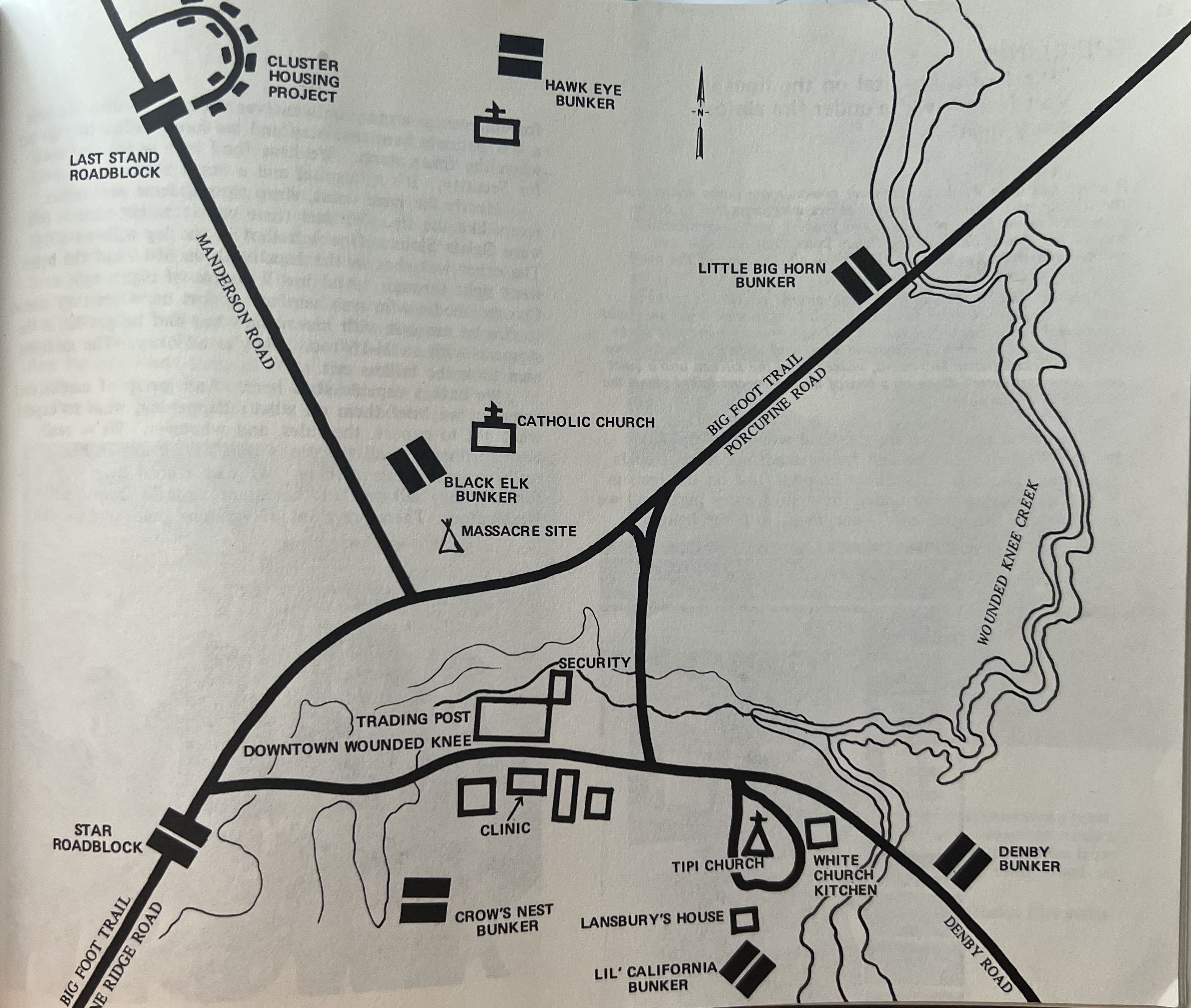
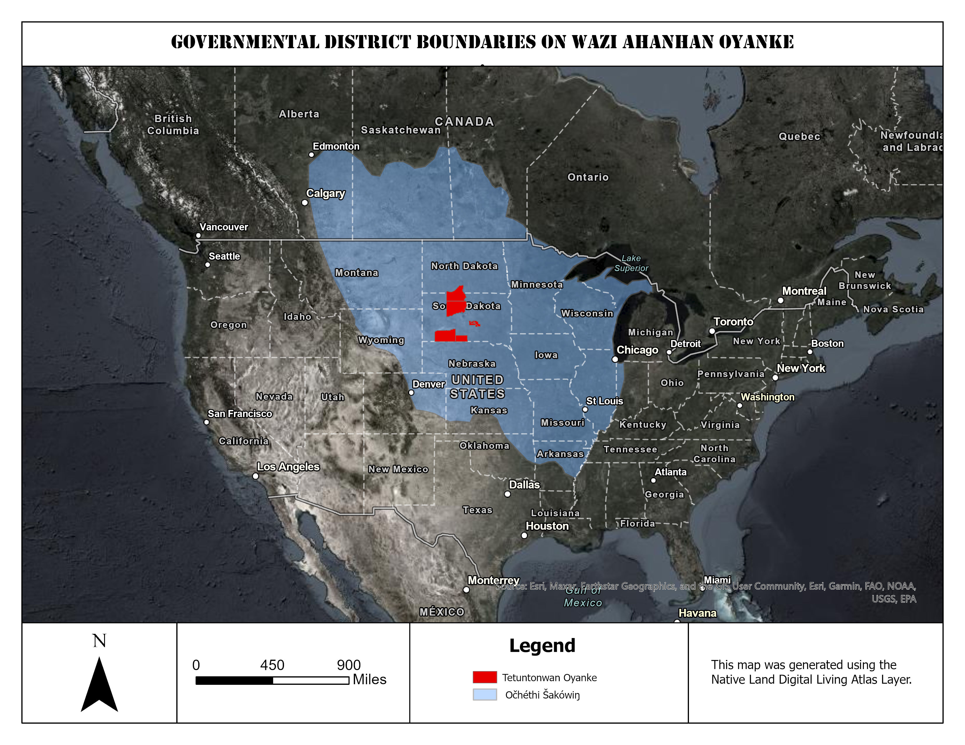
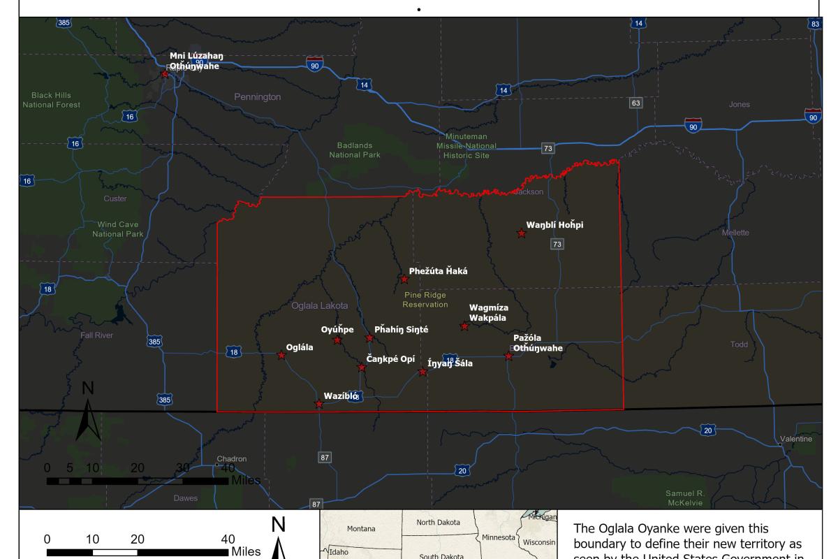
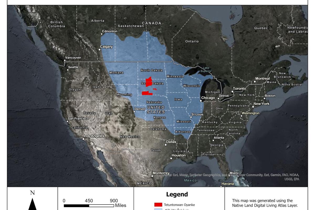
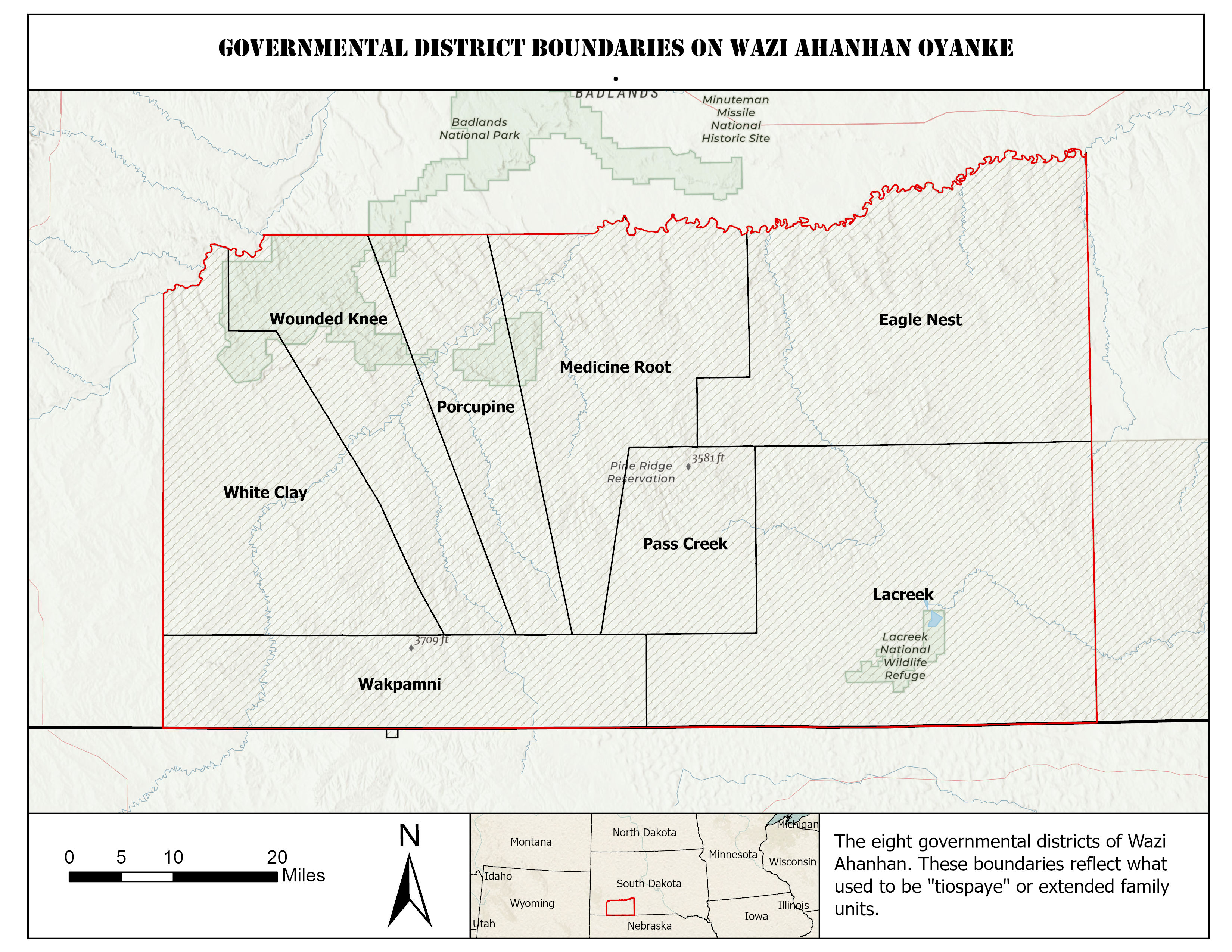
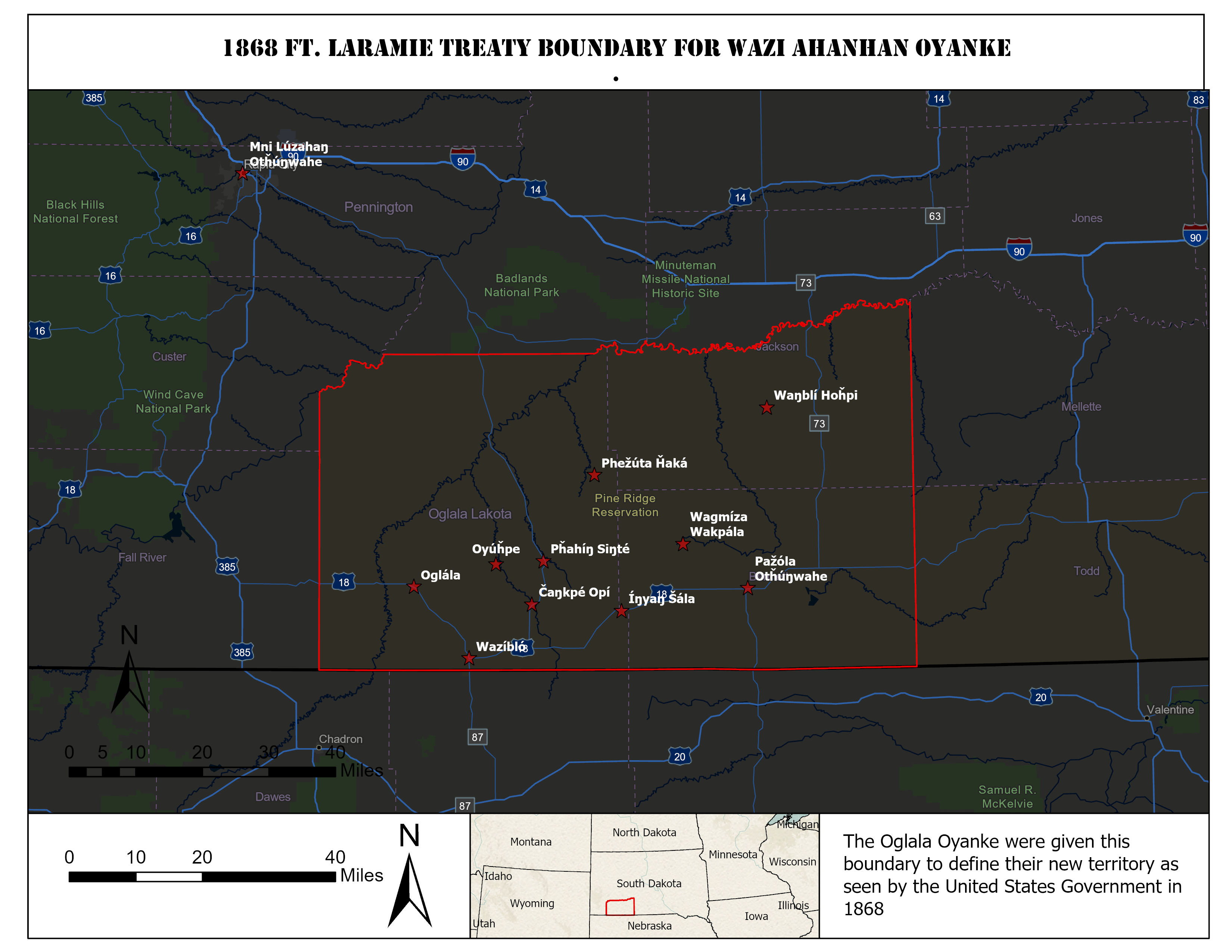
There is a need for digital maps that depict the territories of the Oceti Sakowin, Wazi Ahanhan Oyanke, and the areas of Unci Maka stewarded by them. These maps will document Lakota land and places for the People.
These maps were digitized by Elisha Yellow Thunder for the Oglala Lakota Oyanke to depict Geographical Information Systems for Wazi Ahanhan Oyanke (Pine Ridge Indian Reservations). These maps correlate with geospatial data that can be found at the linked ArcGIS Hub. Please use layers and maps respectfully and in accordance with Lakota data sovereignty.
These maps were created in relation to Lakota Lifeways and knowledge compiled through exstensive research, data aquisition, and lived experience. Some of them are historical and represent the different methods in which Lakota carried their maps.